FCA Brecon Beacons
Steeply graded watercourse
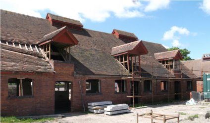
Morton-Roberts produced a Flood Consequence Assessment (FCA) to TAN15 to support a planning application for the construction of a new building near the confluence of a local watercourse and a main river within the Brecon Beacons National Park. The building, part of a farm diversification scheme, was to be located close to the local watercourse. This stream was very steeply graded and had a large bed load. It also flowed over an alluvial fan which meant that if water over-topped the banks it was likely to flow away from the watercourse.
Hydrological Assessment and River Modelling Work
Morton-Roberts carried out a hydrological assessment of the flows in both watercourses using Flood Estimation Handbook (FEH) methods. We also constructed a model of the watercourses using ISIS 1D river modelling software to understand the flooding mechanisms in the area.
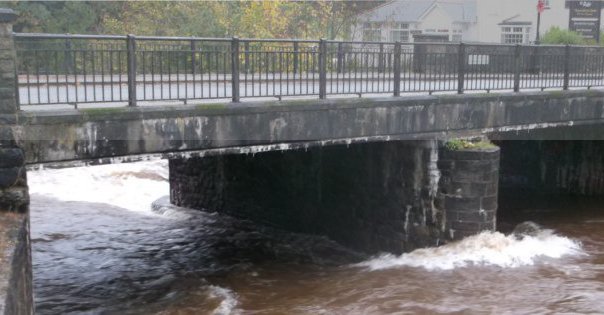
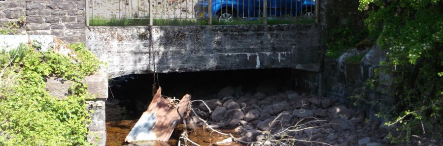
The upstream face of a road bridge over the local watercourse just upstream of the site showed damage likely to have been caused by repeated blockages of the bridge due to the boulders carried by high flows. Given the size of the bridge, this was felt to be likely to be a recurring problem so a 2D Flood Model was constructed to predict the extent of the overland flow resulting from a blockage at the bridge.
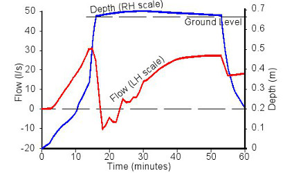
The modelling work allowed us to predict the depths and velocities of the flood water at the site for a variety of return periods. We were then able to confirm that the proposed building would not be affected by the flood water and to determine a safe evacuation route from the site. The modelling work also confirmed that the proposed building did not produced any detrimental effects for a 1 in 1,000 year return period event.
Planning permission
As a result of the FCA the new building gained planning permission.
Further details of our drainage design services
Further details of our services are given within the following pages:
Flood Estimation Handbook (FEH)
Alternatively please contact us for further details of our river modelling capabilities.
Photograph: Downstream face of the road bridge over local watercourse just upstream of the site.